Customize Consent Preferences

We use cookies to help you navigate efficiently and perform certain functions. You will find detailed information about all cookies under each consent category below.

The cookies that are categorized as "Necessary" are stored on your browser as they are essential for enabling the basic functionalities of the site. ... 

Always Active

Necessary cookies are required to enable the basic features of this site, such as providing secure log-in or adjusting your consent preferences. These cookies do not store any personally identifiable data.

No cookies to display.

Functional cookies help perform certain functionalities like sharing the content of the website on social media platforms, collecting feedback, and other third-party features.

No cookies to display.

Analytical cookies are used to understand how visitors interact with the website. These cookies help provide information on metrics such as the number of visitors, bounce rate, traffic source, etc.

No cookies to display.

Performance cookies are used to understand and analyze the key performance indexes of the website which helps in delivering a better user experience for the visitors.

No cookies to display.

Advertisement cookies are used to provide visitors with customized advertisements based on the pages you visited previously and to analyze the effectiveness of the ad campaigns.

No cookies to display.

HomeNewsCyclone Errol Shows 'Some Signs of Weakening' as 'Intense...

Cyclone Errol Shows ‘Some Signs of Weakening’ as ‘Intense Storm’ Swirls Off Western Australia

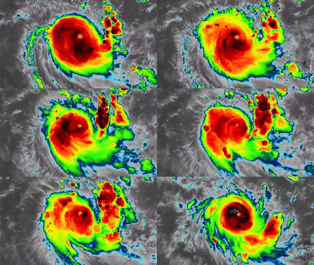
Cyclone Errol showed “some signs of weakening” as it swirled off the coast of Western Australia from Wednesday, April 16, to Thursday, April 17.

The Cooperative Institute for Research in the Atmosphere (CIRA) released this imagery on X, which was captured from 9 am UTC on Wednesday (5 pm AWST on Wednesday) to 9 pm UTC (5 am AWST on Thursday).

“Cyclone Errol, while still an intense storm, is showing some signs of weakening after developing a strong central eye,” the source wrote.

According to the latest information from the Bureau of Meteorology on Thursday, the category 4 cyclone would “start weakening and move towards the west Kimberley coast today.” Credit: CSU/CIRA & JMA/JAXA via Storyful
Source link

- Advertisement -

Worldwide News, Local News in London, Tips & Tricks